|
Originally
called "Muttoneguis" by the Native North Americans,
the island
is located along the United States and Canada border
between Maine and New Brunswick.
|
|
Saint Croix
Island became the site of the first French settlement
in North America in the year 1604.
|
|
 (top)
(top)
|
|
Background
to the 1604 Expedition
|
|
Under
the leadership of King Henri IV, France had recently
emerged from a prolonged period of religious warfare
and civil strife between Catholic and Huguenot (Protestant)
forces.
In
1594, Henri, King of Navarre and titular King of France
converted to Catholicism to consolidate his claim to
the throne and prevent anarchy.
In
1598 he issued the Edict of Nantes, guaranteeing religious
tolerance for the Huguenots.
One
prominent Huguenot, and champion of the King was Pierre
Dugua the Sieur de Mons.
Dugua
was granted the title of Lieutenant-Governor for the
territory between the 40th and 46th parallel (modern
Philadelphia and Labrador) by the King.
|
Dugua
was also granted a trading monopoly for the fur trade,
and was expected to colonize the territory and to convert
First Nation peoples to Christianity.
|
 |
|
(top)
The
1604 Expedition
|
In
March of 1604, five ships carrying 120 men set
sail from Havre de Grace (now Le Havre),
France to establish a settlement in the New World.
The
French expedition was led by nobleman Pierre Dugua
the Sieur de Mons.
|
|
|
Among
those aboard the departing ships were
noblemen, artisans, soldiers, a surgeon,
Roman
Catholic priest and a Huguenot minister
so that the material and spiritual needs
of
the colonists could be met.
|
|
|
Along
with Pierre Dugua the Sieur de Mons, other
prominent members of the expedition
included the cartographer Samuel Champlain, Jean
de Biencourt the Sieur de Poutrincourt and
Francois
Grave the Sieur de Pont (dit Pontgrave).
The expedition landed first at Sable Island on May 1,
1604.
From
there, three ships carrying 41 of the original 120 men
headed to the St. Lawrence River to trade, Pontgrave
sailed for Canso and Dugua, Champlain and Poutrincourt
explored the south coast of Nova Scotia and the Bay
of Fundy.
While
Pierre Dugua searched for an appropriate spot to establish
the settlement, Champlain carefully mapped the inlets
and harbors of the rugged coastline.
Many places along the coasts of Maine, New Brunswick
and Nova Scotia still bear the names given to them by
Champlain.
By late June, after exploring the mouth of the Saint
John River, Dugua's group of 79 men sailed into Passamaquoddy
Bay and up a river.
Here
they found an island situated inland near the confluence
of what appeared to be three rivers resembling the arms
of a cross.
|
|
|
|
Dugua
named the island "Isle de Sainte Croix".
Immediately
work began on clearing the island and neighboring mainland
to construct their dwellings, a kitchen, a storehouse,
a blacksmith shop and a chapel.
With construction going well, Champlain was sent off
by Dugua to explore further south.
On his voyage, Champlain went as far as Mount Desert
Island and named it "Isle des Monts Deserts".
Champlain returned to St. Croix Island in late September
to find the dwellings completed.
(top)
|
|
On
October 6, the first signs of winter were upon the settlers,
it snowed.
Before long, the river filled and jammed with ice flows
and the men on the island were cut off from the mainland.

They
began to suffer from a shortage of drinking water and
firewood.
Their cider froze and had to be doled out by the pound.
The settlers were forced to drink Spanish wine and melted
snow.
Out
of seventy nine men, thirty five died and another twenty
were very near to death.
|
 |
In
March 1605, Native people brought the men fresh game
and traded for bread and other goods.
The health of the men began to return.
|
|
When
Pontgrave's ship arrived on June 15, 1605, Dugua had
already made the decision to move the settlement to
a more suitable site.
Dugua
and Champlain continued to explore the southern coastline,
traveling as far as Cape Cod before returning to St.
Croix Island without having found a more suitable site,
Pierre Dugua then decided to relocate across the Baie
Francaise (Bay of Fundy).
|
|
By
early August 1605, the settlement at St. Croix Island
was being dismantled to move to the Annapolis Basin
in Nova Scotia.
Port Royale, as named by Champlain, was the crew's new
home.
St.
Croix Island would be revisited by members of the Port
Royale settlement in the following years, but never
re-occupied as a permanent settlement by them.
|
 |
|
Historical
Events After 1604
|
|
|
1606_1607
Samuel
Champlain and Sieur de Poutricourt visit the island
and note the gardens are still producing.
Dugua's
monopoly is revoked.
|
|
1613
Captain Argall Virgina (settled 1607) carries out orders
to drive the French from the coast.
He
destroys the remaining buildings at Saint Croix Island
and sails to Port Royal burning that settlement.
|
|
1697
The St. Croix River is set as the boundary between the
British Provinces of Massachussetts Bay and Nova Scotia.
|
|
1783
Treaty
of Paris ended the American War of Independence and the
St. Croix River was established as the international boundary. |
|
1797
Disagreement
between the neighbouring Governments as to the location
of the St.Croix River and Island are settled when Robert
Pagan, using Champlain's maps and documents, finds ruins,French
brick,and pottery, on what was then called Docea's Island.
|
|
1800's
The
island is settled, quarried for sand and a light station
is erected.
(top)
|
|
1904

|
|
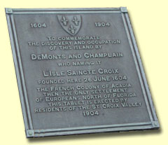
On
June 25, the 300th anniversary of the settlement
on St. Croix Island was celebrated with ceremonies
on the island.
Three warships, from the United States, Great
Britain, and France anchored north of the island.
A commemorative plaque was unveiled on the island.
Ceremonies were also carried out in Saint John,
N.B., Port Royal, N.S. and in Calais, Maine.
|
|
|
1949
On
June 8, the United States Congress authorized St. Croix
Island as a national monument.
|
|
1968
On
June 30, St. Croix Island was formally dedicated as
a national monument. At the same time, the Historic
Sites and Monuments Board of Canada recommended Parks
Canada cooperate with the U.S. Parks Service in the
preservation of the island.
|
|
1982
A memorandum of understanding was signed by Canada and
the United States for the protection and commemoration
of St. Croix Island with interpretation sites to be
established by each country.
|
|
(top)
1984
On
September 25, the national monument was re-designated
by the US Congress as Saint Croix Island International
Historic Site.
|
|
1995
On
July 18 a workshop was hosted by the St. Croix International
Waterway Commission, resulting in the generation of
numerous ideas on how to commemorate the 400th anniversary
of the settlement.
|
|
1996
An
amendment to the 1982 international memorandum was signed
by Canada and the United States pledging support for
the 400th anniversary commemorations in 2004.
|
|
1996
On
November 7, the Ste-Croix 2004 Coordinating Committee,
an international organization comprised of Canadians
and Americans was established at a public meeting held
in Calais, Maine.
(top)
|
|
2000
The Ste-Croix 2004 Committee hires its first staff person,
becomes incorporated as a not for profit corporation
on both sides of the border and applies for charitable
status in Canada and the United States.
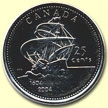
Official requests for special commemorative 2004 coins
and stamps is made in both countries.
|
 |
|
2001
The
Ste-Croix 2004 Committee launches its official website
and marks the 397th anniversary of the landing at St.
Croix Island with a cruise to the island.
The
Town of St. Stephen passes a municipal resolution in
support of 2004 efforts.
The City of Calais, the Town of St. Andrews and St.
Stephen commit to annual funding support.
|
|
2004
June
25- July 4th International Celebrations commemorating
the 400th Anniversary of the First French settlement
in North America.
The
International Historic Site at Bayside, New Brunswick,
Canada is officially opened.
|
| |
|
|
View
links to other related web sites from the local area.
|

